Flight Plan Report
Once you are finished with creating a flight plan, you may
generate a report and the result will be
saved to your profile. A flight plan
must include takeoff and landing airport locations, and at least one flight line.
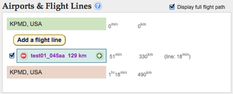
Flight time estimates are calculated dynamically whenever an item is added, deleted, copied, or rearranged in the flight plan.
Generate Plan
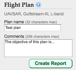
Under "Flight Plan", at the bottom right corner of the screen, you may select "SAR mode" or "Nadir mode" and the "G3" airplane or the "Global Hawk." Additionally,
please choose a name for your flight plan and enter a
description of its objectives.
Currently,
only SAR mode and the G3 can be selected. A future version of this software will have the capability to plan flights for nadir viewing instruments and a variety of aircraft platforms.
When you are ready, click the
"Create Report" button. A flight plan report webpage will be generated (like the one below) in a pop-up window with links to a
summary,
map, and
configuration file.
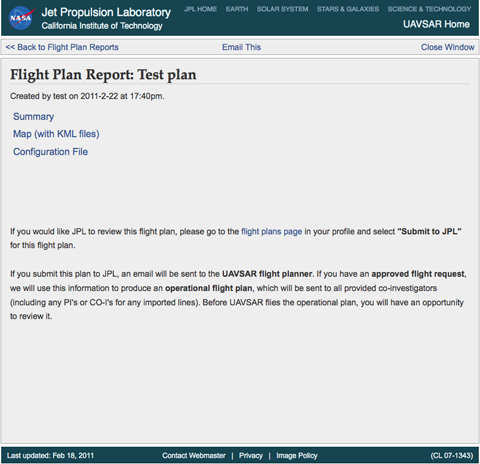
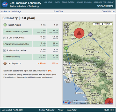
Summary
The summary contains all the
flight time estimates, as well as the
estimated cost of the flight plan at the bottom. Click the
airport icons to the left of the airports or the
plus [+] signs to the left of the lines and intermediate airports to find out more information.
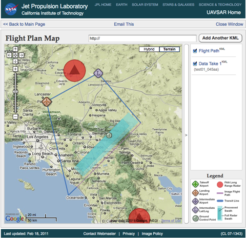
Map
The map webpage allows you to view the plan in a
larger map and
download the KML files for the full flight path and each individual image swath.
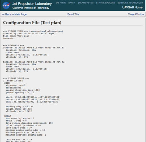
Configuration File
The configuration file contains more
detailed information about the flight plan and is mainly used by the UAVSAR
science coordinator to help put together a final flight plan.
View Previous Plans
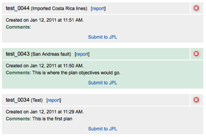
In your user profile, you can find a link to
previous flight plans.
Here, you can
access the reports for previous flight plans,
delete flight plans, and
submit a plan to JPL to be reviewed.
 Jet Propulsion Laboratory
California Institute of Technology
UAVSAR Home
Jet Propulsion Laboratory
California Institute of Technology
UAVSAR Home