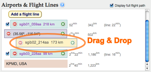
In the "Airports & Flight Lines" section below the map, you may view and modify the order that the flight plan will be executed in.
The plan items are listed in this order below the map:
Takeoff Airport
Flight Lines & Intermediate Locations (can drag & drop to re-order)
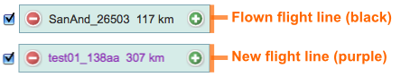
Click the checkbox to display/hide the flight line image swath in the map.
Note: a flight line may not be modified while it is hidden (unchecked).
Landing Airport
Ground Control Points
Imported KML files
Check/uncheck to display/hide the KML in the map.
Note: These Keyhole Markup Language (KML) files are not saved in the flight plan report.
Flight time estimates, seen to the right of the different items below, are calculated dynamically whenever an item is added, deleted, copied, or rearranged in the flight plan.
An item (flight line, airport, etc) can be selected by clicking on it in the list (like the one above), or by clicking its corresponding icon in the map. Once selected, you can edit the item's information to the right of the map.
An item may be deleted by clicking on its remove button (-), or cloned by clicking on its copy button (+). Ground control points may be viewed below the flight plan, and edited similarly.
A video demonstration may be viewed here (no sound). We recommend using full screen and watching in HD.
 Jet Propulsion Laboratory
California Institute of Technology
UAVSAR Home
Jet Propulsion Laboratory
California Institute of Technology
UAVSAR Home