Technology > Calibration > SWOT Calibration
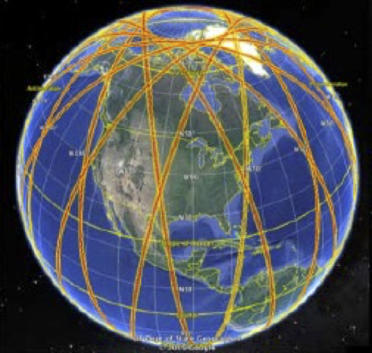
SWOT Mission
The SWOT mission is a satellite altimeter jointly developed by NASA and CNES, the French space agency, in partnership with the Canadian Space Agency (CSA) and UK Space Agency (UKSA). The objectives of the mission are to make the first global survey of the Earth's surface water, to observe the fine details of the ocean surface topography, and to measure how terrestrial surface water bodies change over time. The SWOT mission is composed of several instruments: a dual-frequency (Ku and C-band) nadir altimeter; KaRIn, a Ka-band radar interferometer; a dual-beam water vapor radiometer (Advanced Microwave Radiometer, AMR); and, a Doppler Orbitography and Radiopositioning Integrated by Satellite (DORIS) beacon, a Global Positioning System (GPS) receiver, a Laser Retroreflector Array (LRA), star trackers, and gyros, for precision orbit and attitude determination. See here for additional information.
SWOT Calibration
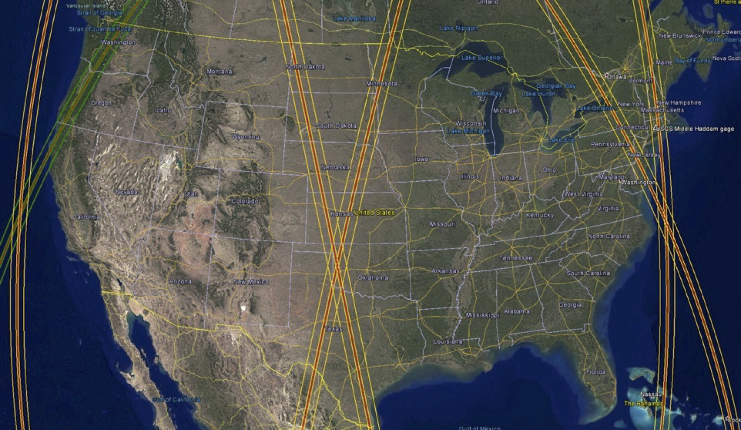
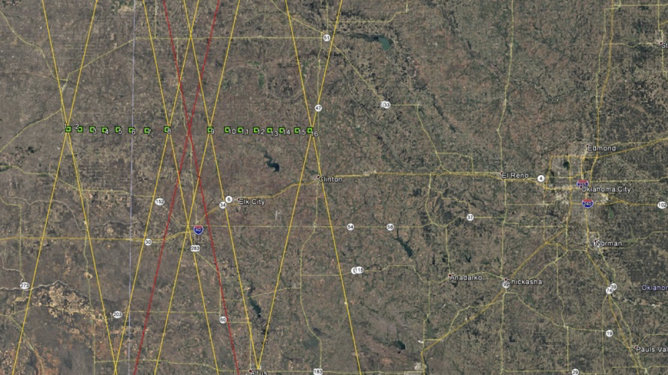
Post-launch cal/val activities may involve imaging well established ground targets. KaRIn cal/val will partially use a Corner Reflector (CR) array as these targets are commonly used for SAR systems. As many as 16 corner reflectors located at SWOT orbit crossover swaths over the Oklahoma and Texas areas will be deployed for KaRIn calibration.
SWOT Calibration Array
Construction
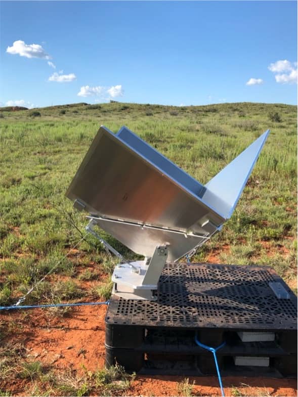
Each CR measures 0.8 meter (2.6 ft) and is a square-trihedral reflector composed of honeycomb-aluminum sheets which are precision bonded to obtain 90° orthogonality (+/- 0.1°), and then mounted in a cradle that can be tilted to optimize Radar Cross Section (RCS) return. These cradles are mounted to two shipping pallets to support the structure, and these shipping pallets are then staked at the center and retained out to the sides with AmSteel-Blue to turnbuckles and metel stakes buried up to 14" into the ground.
Deployment
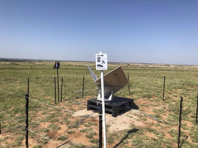
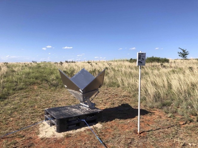
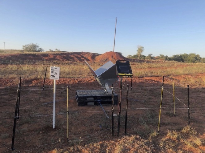
Trial deployment of three SWOT CRs occurred in June, 2021 on the Black-Kettle Grasslands in Oklahoma. The images below are from left to right, S02K, S03K, and S04K. These targets are all in the Western swath and all are East facing CRs.
SWOT reflector S02K, red-dirt hill
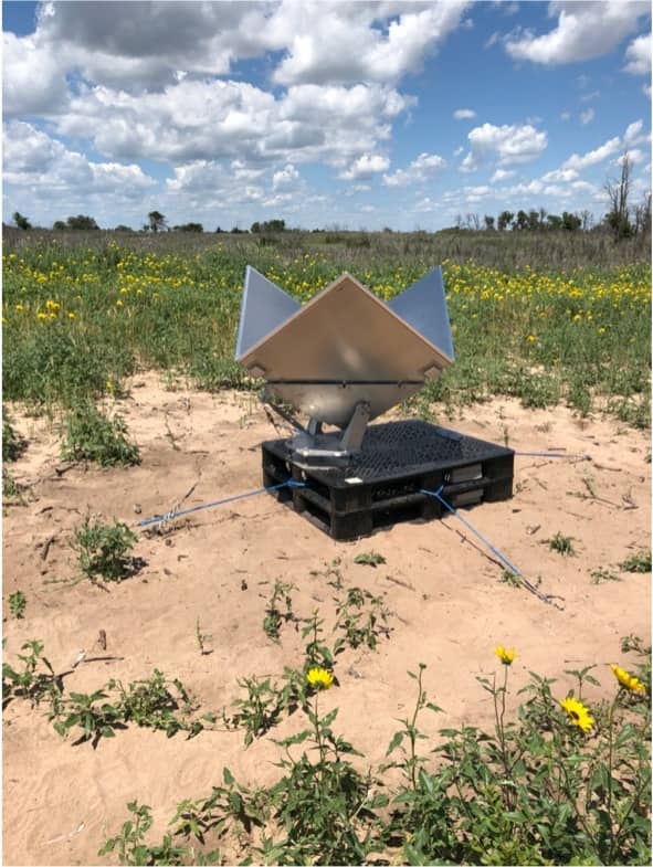
SWOT reflector S03K, daisy field
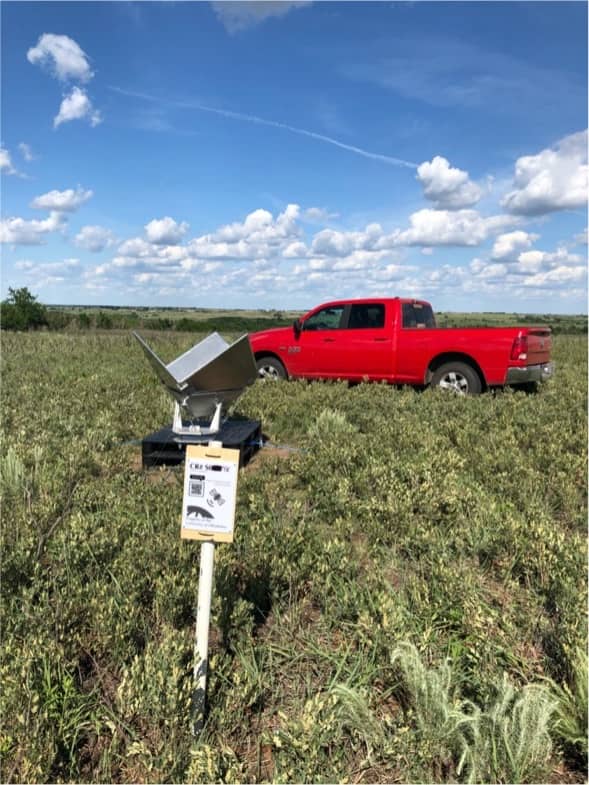
SWOT reflector S04K, caterpiller plateau
Coordinates
The coordinates listed here are in IGS14 Reference Frame. See a chronology of reference frames for additional information. The coordinates are expressed as WGS-84 geodetic latitude and height above the reference ellipsoid such that:
- a = 6,378,137 meters
- f = 1/298.257222
The coordinates are referenced to epoch 4-June-2021 and modeled with 1.5364 cms/year of plate motion with an azimuth direction of 254°. Specifically the changes in East, North, and Vertical are modeled as:
- delta_east_in_meters = -0.01486 * ( gps_time_past_4-June-2011_in_secs) / 365.25 / 86400
- delta_north_in_meters = -0.00428 * ( gps_time_past_4-June-2021_in_secs) / 365.25 / 86400
- delta_vertical_in_meters = 0.0 * ( gps_time_past_4-June-2021_in_secs) / 365.25 / 86400
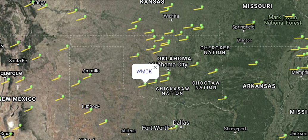
These rates are the averge of a multi-year time series analysis of the permanent CORS sites OKSY and OKCL. The PBO site WMOK for example here also shows simliar horizontal plate motion.
Nearby velocity vectors from GPS multi-year GPS analysis
Accuracy & History
June 2021
Initial deployment of S02K, S03K, S04K occurred June 4, 2021. Sites locations were computed relative to reference site SWOT with single-frequency GPS RTK. The reference site SWOT is 10 meters West and 6 meters North of S03K. Over 22.5 hours of GNSS data was collected for the SWOT reference site. It is believed that the vertical accuracy of these SWOT corners vertices for S02K, S03K, S04K is better than 1/2 CM 1-sigma.
December 2021
Additional GNSS data was collected at S02K, S03K, and S04K and their positions were redetermined with respect to the SWOT reference site with single-frequency GPS RTK. Vertical positions of S04K and S03K were < 1 CMS from their surveyed heights in June, 2021. S02K was known to have metrology errors from the June 4th survey. At this time we also installed S01K on December 14, 2021 at the Washita National Wildlife Refuge near Butler Oklahoma. Site location was computed relative to a new reference site we are calling SEOT with single-frequency GPS RTK. The reference site SEOT is 3.7 meters West and 2.8 meters North of S01K. Over 24 hours of GNSS data was collected for both the SEOT reference site and for S01K. It is believed that the vertical accuracy of S01K corner vertex is better than 1/2 CM 1-sigma. The image below on the right was taken March 7, 2022 and shows the square-trihedral S01K in very good condition.
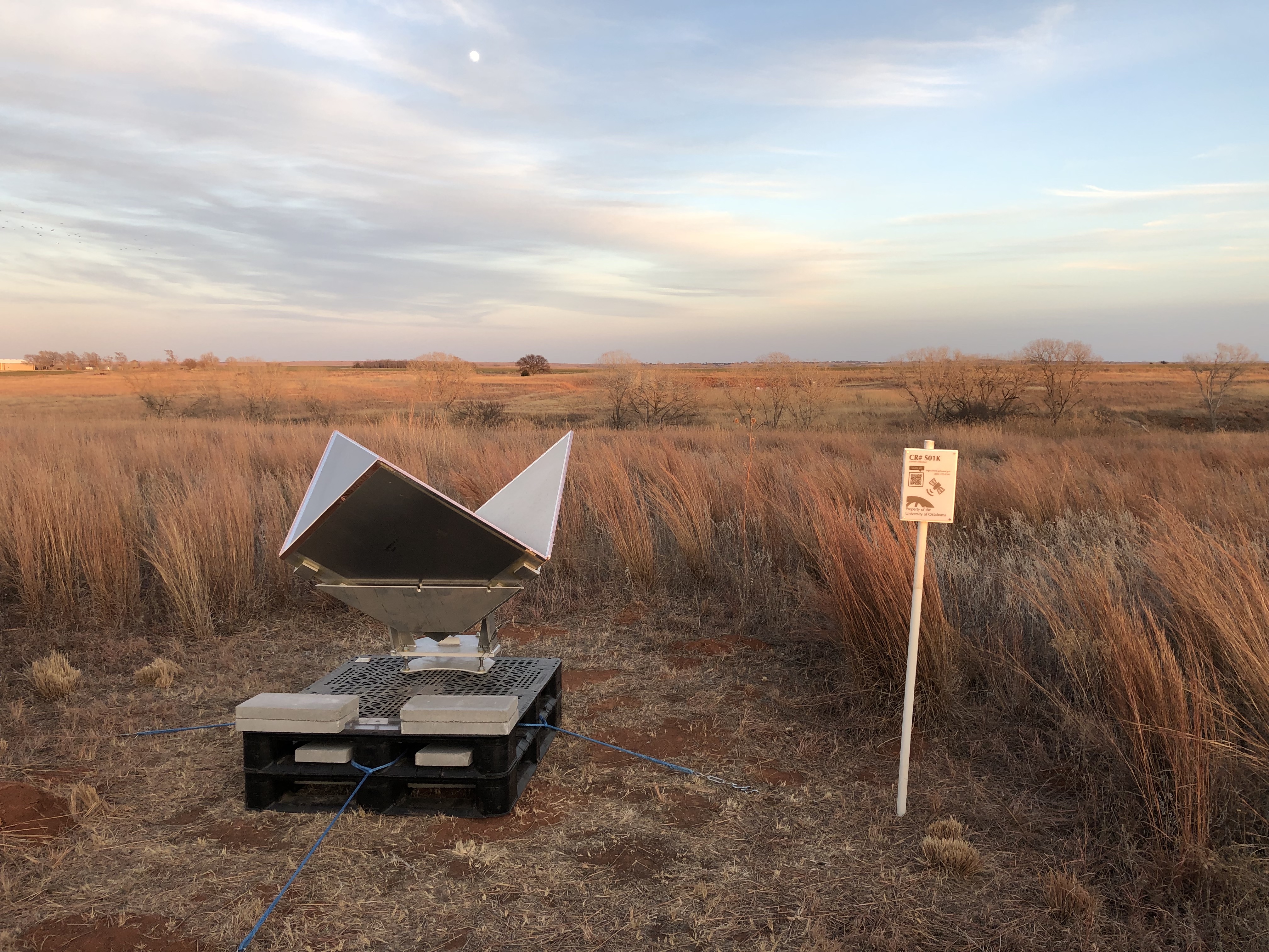
Newly Installed West Facing CR S01K, December 14, 2021
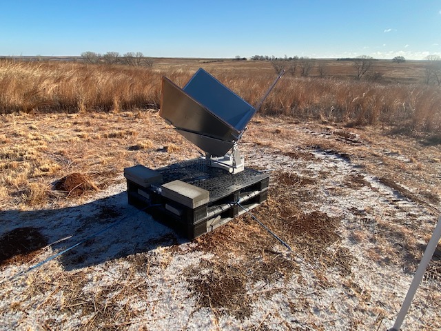
Photo credit to Carla Weinkauf, Refuge Manager.
June 2022
SWOT corner cubes S05K, S06K, S07K, S08K, S09K, and S10K were established in the Eastern swath. Tilts and azimuths for S02K, S03K, S04K, and S01K were also remeasured. Site location are computed relative to new reference sites RONB near S06K and FARM near S09K. It is believed that the vertical accuracy of all these new sites is better than 1/2 CM 1-sigma relative to their reference sites. The image below on the right was taken June 22, 2022 and shows the square-trihedral S05K after initial deployment. The image below on the left was taken June 23, 2022 and shows the square-trihedral S10K after its initial deployment.
Newly Installed West Facing CR S05K, June 22, 2022
Newly Installed West Facing CR S05K, June 23, 2022
September 2022
SWOT corner cubes S11K, S12K, S13K, S14K, and S15K were established in the Western swath. S16K were established in the Eastern swath. Site location are computed relative to new reference sites COOK near S13K and CARR near S15K. It is believed that the vertical accuracy of all these new sites is better than 1/2 CM 1-sigma relative to their reference sites. The image below on the right was taken September 2022 and shows the square-trihedral S13K and S16K after initial deployment.
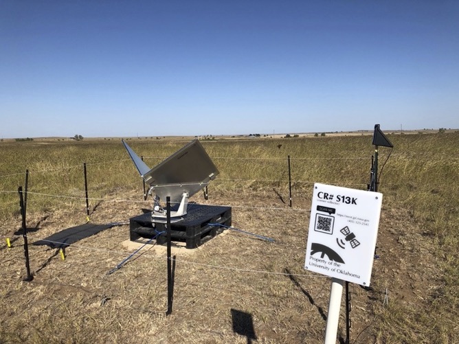
Newly Installed East Facing CR S13K, September, 2022
Newly Installed West Facing CR S16K, September, 2022
January 2023
All 6 SWOT reference sites were resurveyed, and the CRs associated with the reference sites were adjusted. No baselines were remeasured. Data prior to this survey is from 1-oct-2022 to 31-dec-2022. Data after 1-jan-2023 to 14-may-2023 is based on this January 2023 resurveying of only the reference sites. From West to East:
| Reference Site | CRs associated with reference site | East Change from 2022 | North Change from 2022 | Vertical Change from 2022 |
|---|---|---|---|---|
| CARR | S15K | 0.4 cms | 0.0 cms | 0.4 cms |
| COOK | S14K, S13K, S12K | -1.6 cms | 1.0 cms | 0.4 cms |
| SWOT | S11K, S04K, S03K, S02K | -1.3 cms | 0.9 cms | 0.9 cms |
| FARM | S10K, S16K, S09K, S08K | -0.1 cms | 0.8 cms | -0.2 cms |
| SEOT | S01K | -0.6 cms | 0.9 cms | 0.1 cms |
| RONB | S07K, S06K, S05K | -0.9 cms | 0.3 cms | -0.5 cms |
May 2023
| SWOT CR | Facing | East Change from Jan 2023 | North Change from Jan 2023 | Vertical Change from Jan 2023 |
|---|---|---|---|---|
| S15K | East | -0.4 cms | 0.5 cms | -0.3 cms |
| S14K | East | 0.3 cms | -1.3 cms | -0.9 cms |
| S13K | East | 0.1 cms | -0.8 cms | 0.1 cms |
| S12K | East | 1.5 cms | -1.1 cms | -0.9 cms |
| S11K | East | 5.9 cms | -2.4 cms | -0.1 cms |
| S04K | East | -0.1 cms | 0.0 cms | -0.7 cms |
| S03K | East | -0.1 cms | 0.0 cms | -0.7 cms |
| S02K | East | -0.6 cms | 0.2 cms | -1.3 cms |
| S10K | West | -0.5 cms | -0.2 cms | 0.0 cms |
| S16K | West | -0.5 cms | -0.2 cms | 0.0 cms |
| S09K | West | -0.5 cms | -0.2 cms | 0.0 cms |
| S08K | West | -0.5 cms | -0.2 cms | 0.0 cms |
| S01K | West | -0.4 cms | 0.1 cms | -0.3 cms |
| S07K | West | -0.3 cms | -0.7 cms | 0.5 cms |
| S06K | West | -0.3 cms | -0.7 cms | 0.5 cms |
| S05K | West | -0.3 cms | -0.7 cms | 0.5 cms |
Decommisioning Phase
October 11, 2023
The calibration and validation phase for SWOT,s KaRIn instrument ended summer of 2023 and the first batch of SWOT corner reflectors begin to be removed. First removed are the S11K, S12K, S13K, S15K from the western swath, along with S01K, S05K, S06K, and S07K in the eastern swath.
October 30, 2023
The second batch of SWOT corner reflectors are removed. This includes S09K, S10K, and S16K. These are all in the eastern swath.
December 7, 2023
The final batch of SWOT corner reflectors have been removed. This included S08K, S02K, S03K, S04K, and S11K.
Corner Reflector (CR) Data
KMZ file of all 16 deployed SWOT CRs (deployed June 2021, Dec 2021, June 2022, and Sept 2022)
Use the 'Get Corner Reflector Data' button to retrieve the vertices of the the SWOT corner reflectors (latitude, longitude, orientation, etc) for a particular date. Data goes back to June 4, 2021 and ends October 11, 2023. Output is a comma-separated value (CSV) file.
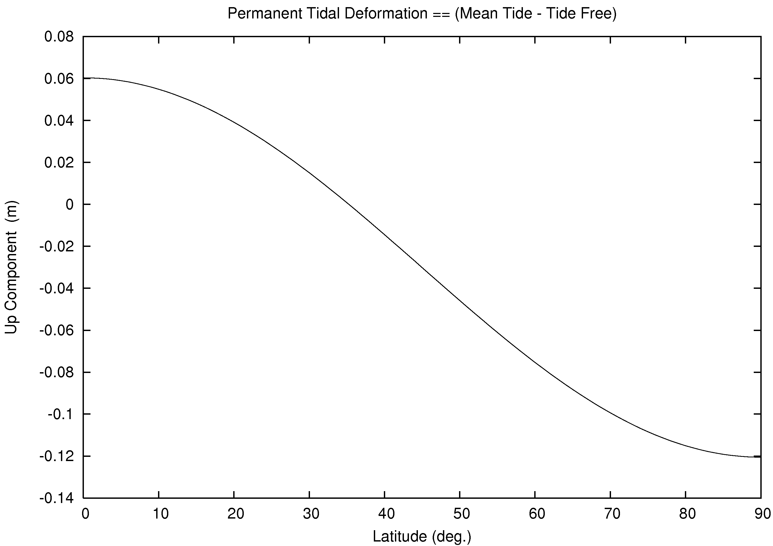
Select type tide-free for conventional tide-free crust (ITRF), select type instantaneous-crust for instantanous observed crust, and select type mean-crust for permanent tide. See for example, terrestial reference systems, particulary Figure 1.1 for additional information. The entered date applies the average plate motion of nearby GNSS sites OKSY and OKCL in addition. The date also applies the solid tide, pole tide, and ocean tide with the FES2014b Ocean Tide Model and center of mass due to both solid Earth and ocean. The reference system instantaneous-crust is a function of latitude, longitude, and the entered time. The reference system mean-crust is a function of latitude only. See for example, permanent tide deformation.
Coordinate Type:
Get Corner Reflector Data
Use the 'Get Tide Data' button to retrieve 48 hours of the tide perturbations centered at the entered date.
Get Tide Data
Contact:
Alexandra Christensen
Jet Propulsion Laboratory
Mail Stop 300-149
4800 Oak Grove Drive
Pasadena, California, 91109
Tel: (818) 393-9004
Email: alexandra.l.christensen@jpl.nasa.gov