News
 May 4, 2026
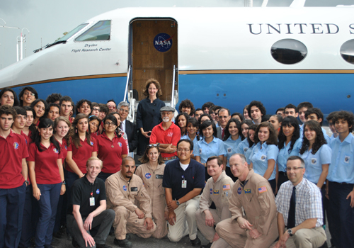
US Embassy Welcomes NASA Aircraft and Scientists to Panama
The United States Embassy in Panama welcomes NASA's Gulfstream C-20A research aircraft and team of scientists visiting today through May 9 as part of a science campaign to study tropical biodiversity
Read More
 Dec 24, 2025
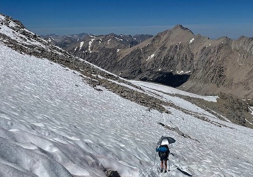
UAVSAR observations advance snow monitoring
SnowEx campaign results enable high-resolution snowpack monitoring with the NISAR satellite.
Read More
 Mar 20, 2025
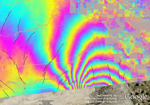
NASA Uses Advanced Radar to Track Groundwater in California
Mapping water recharge signatures with interferometric SAR
Read More
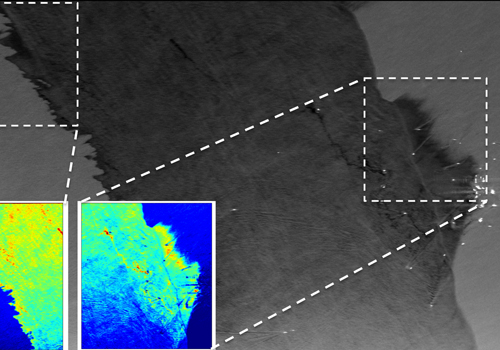
 Feb 24, 2025
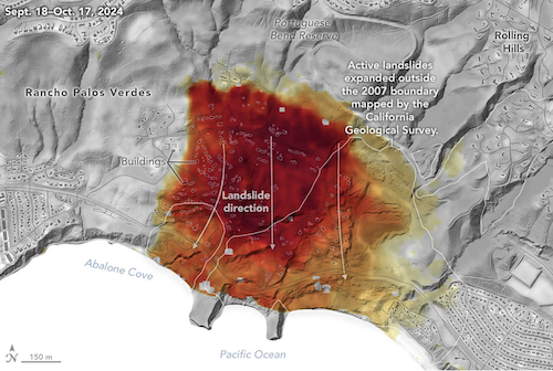
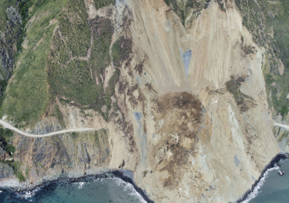
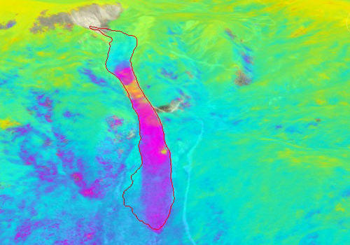
UAVSAR Imagery Reveals Details About Los Angeles-Area Landslides
Change detection analyses show ground movement following record-breaking rainfall in Southern California in 2023 and another heavy-precipitation winter in 2024.
Read More
 Dec 10, 2024
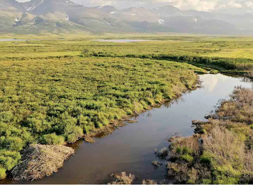
Arctic Beavers Advance North and Accelerate Permafrost Thaw
As beavers build dams in new areas, they impound water, warming permafrost adjacent to their ponds.
Read More
 Nov 25, 2024
New View of the City Under the Ice
Greenland's Camp Century was imaged by the UAVSAR P-Band instrument in April 2024.
Read More
 Oct 12, 2024
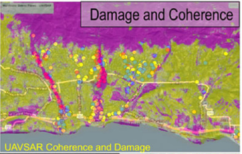
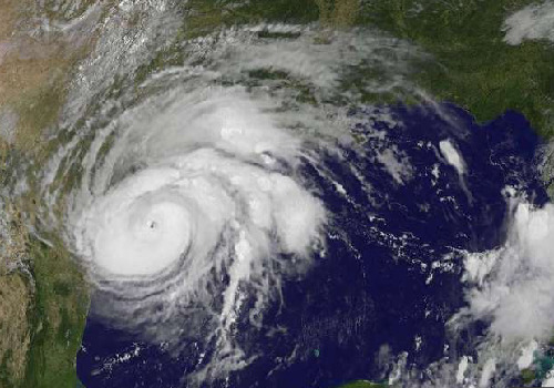
UAVSAR Helps Assess Impacts from Hurricane Milton
NASA canvases the areas impacted by Hurricane Milton using cloud-penetrating L-band radar providing responders insight into flooding across Florida.
Read More
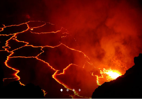
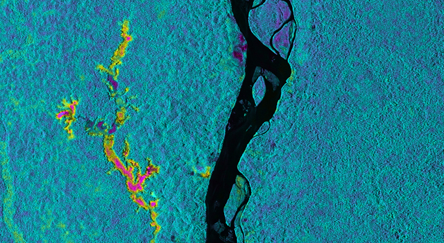
 Dec 19, 2022
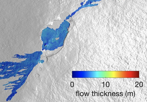
Airborne NASA Radar Maps Mauna Loa Lava Changes in Hawaii
Teams from NASA's Jet Propulsion Laboratory and the United States Geological Survey (USGS) used UAVSAR's Ka-Band observations to map the thickness of lava flows during a series of flights in December
Read More
 Dec 13, 2021
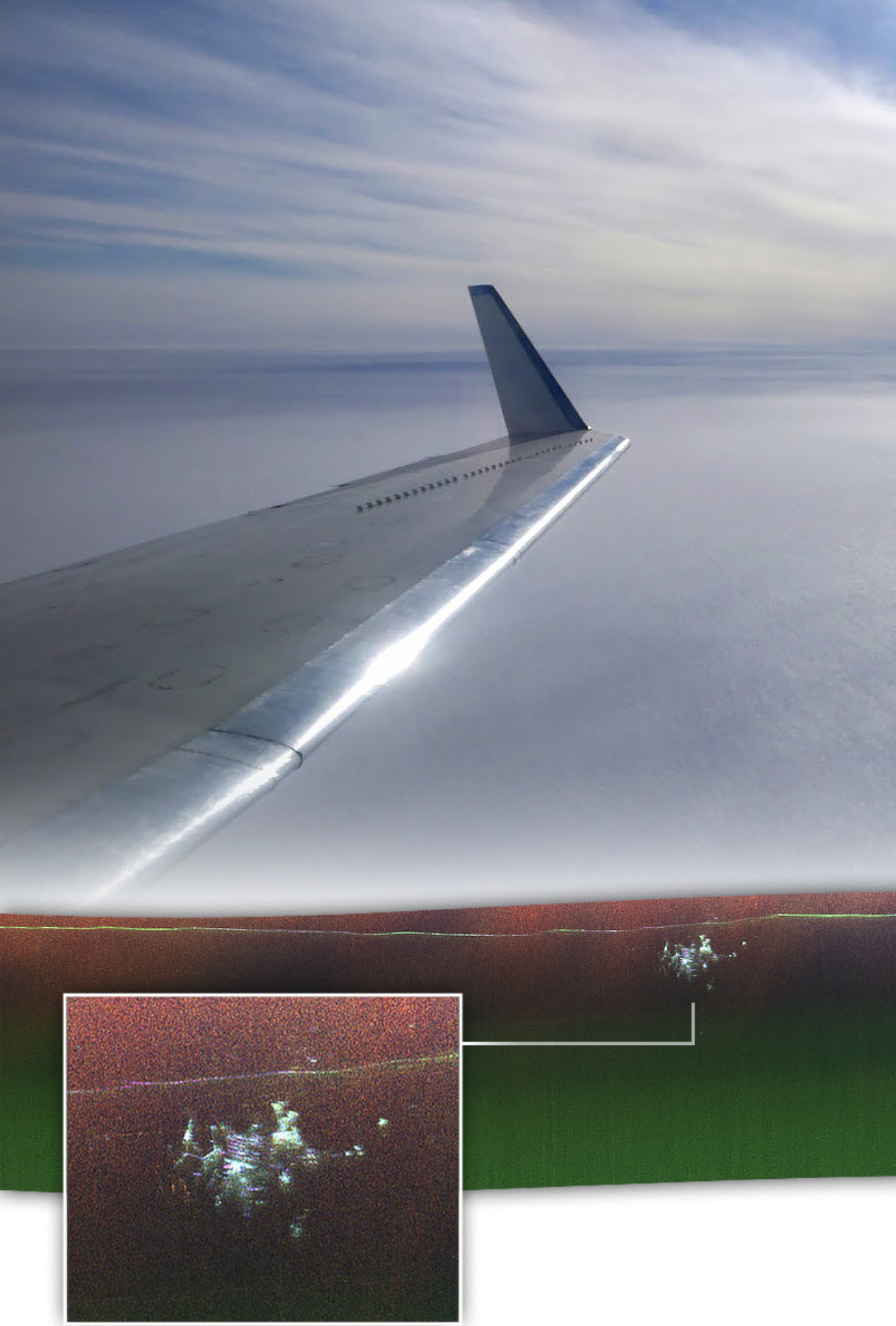
NASA-NOAA Tech Will Aid Marine Oil Spill Response
NASA and National Oceanic and Atmospheric Administration scientists are teaming up to test remote sensing technology for use in oil spill response.
Read More
 Sep 15, 2020
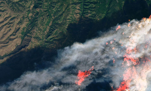
NASA Takes Flight to Study California's Wildfire Burn Areas
The flights are being used to identify structures damaged in the fires while also mapping burn areas that may be at future risk of landslides and debris flows.
Read More
 Jun 2, 2020
New paper on landslide dynamics
New methods for integrating UAVSAR and satellite observations have produced 3D displacement maps with unprecedented amount of detail and shed light on the impact of rainfall.
Read More
 Feb 8, 2019
Drought then Deluge Turned a Stable Landslide into Disaster
For the first time, scientists have documented the transition of a stable, slow-moving landslide into a catastrophic collapse, showing how drought and extreme rains likely destabilized the slide
Read More
 Nov 20, 2018
NASA Mobilizes to Aid California Fires Response
UAVSAR observations collected over the Woolsey and Hill fires will be combined with optical and thermal data to characterize fire scars and aid studies on landslide hazards.
Read More
 Sep 14, 2018
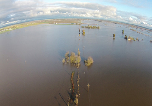
Hurricane Florence Resources - UAVSAR
UAVSAR imagery provides an opportunity to map floodwater extent areas impacted by Hurricane Florence
Read More
 Jun 1, 2018
GLISTIN-A helps researchers understand the Kilauea eruption
The NASA Disasters Program webpage features a Story Map describing GLISTIN's contribution to Kilauea monitoring efforts.
Read More
 Feb 12, 2018
UAVSAR Shows Effects of Deadly California Debris Flows
Processed UAVSAR imagery show surface disruption caused by the debris flows following the Thomas Fire in Santa Barbara and Ventura counties.
Read More
 Aug 31, 2017
Sink or Swim? Using Radar to Protect California's Water Supply
Dr. Cathleen Jones talks on Oct 19 and 20 about her research on monitoring California levees with Synthetic Aperture Radar. A live stream is available.
Read More
 Aug 31, 2017
NASA Working with Partners to Provide Harvey Response
The UAVSAR team is working in collaboration with Texas researchers and government to produce observations over rivers, flood plains and critical infrastructure.
Read More
 May 24, 2017
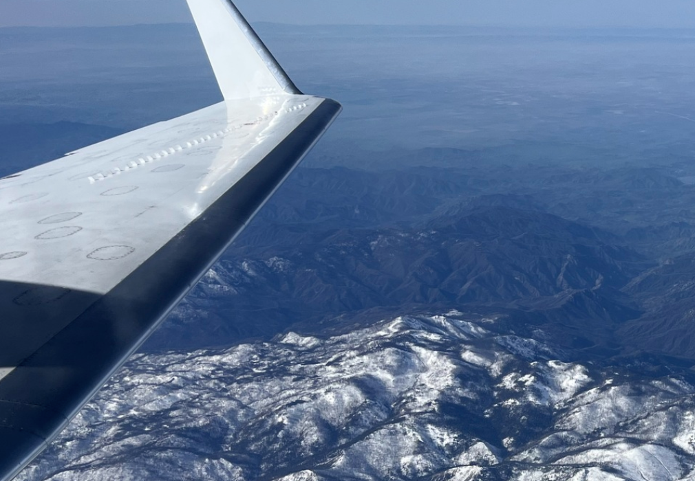
NASA's Arctic Ecosystem Science Flights Begin
A NASA-led effort to advance our ability to monitor changing Arctic and boreal ecosystems has started its second season
Read More
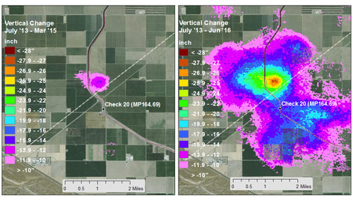 Feb 28, 2017
NASA Data Show California's San Joaquin Valley Still Sinking
JPL scientists compared multiple satellite and airborne InSAR images of Earth's surface to produce maps showing how subsidence varies over space and time.
Read More
 Feb 8, 2017
NASA-Led Campaign Studies Hawaii's Iconic Volcanoes
A multi-instrument deployment will help us better understand volcanic processes and help mitigate volcanic hazards.
Read More
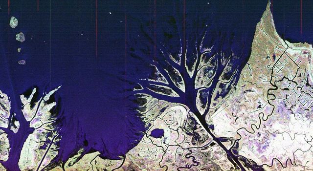
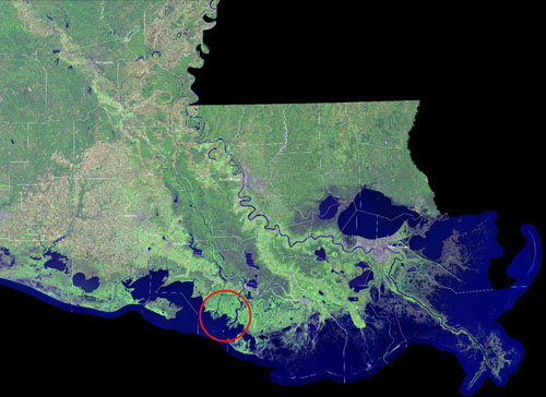 Feb 8, 2017
NASA Studies a Rarity: Growing Louisiana Deltas
Instruments mounted on aircraft can be used to study the growing deltas.
Read More
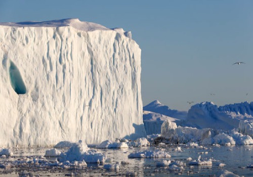
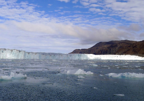 Dec 21, 2016
NASA Releases New, Detailed Greenland Glacier Data
The Oceans Melting Greenland campaign has released new, more accurate maps of Greenland's coastal glaciers
Read More
 May 16, 2016
New Study Maps Rate of New Orleans Sinking
Scientists from California and Louisiana use UAVSAR imagery to produce estimates of land sinking rates in New Orleans.
Read More
 Feb 25, 2016
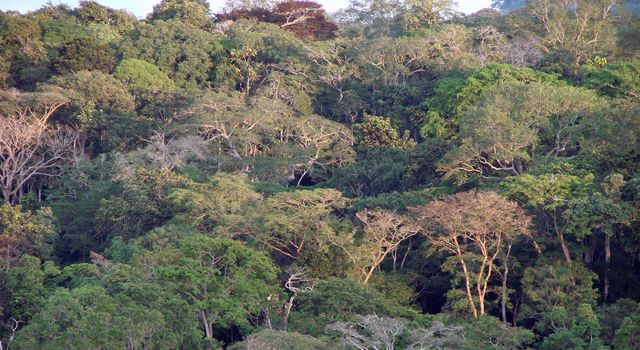
NASA, Partner Space Agencies Measure Forests In Gabon
A contingent of NASA airborne instruments and scientists to study the dense African tropical forests in Gabon.
Read More
 Jan 27, 2016
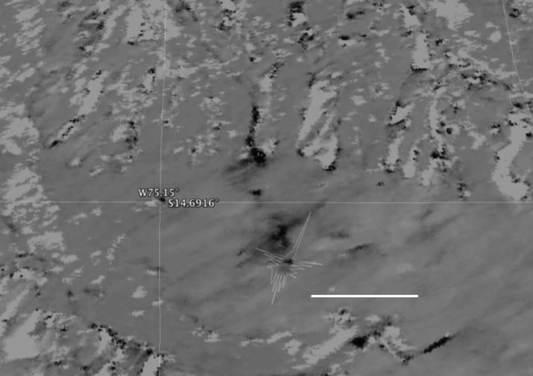
NASA Radar Brings a New View of World Heritage Site
Airborne NASA synthetic aperture radar proved it could pinpoint areas of disturbance in Peru's Nazca lines World Heritage Site.
Read More
 Oct 20, 2015
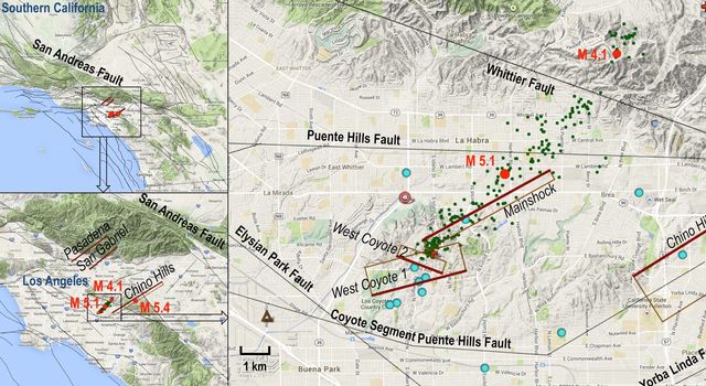
NASA Study Improves Understanding of LA Quake Risks
A new NASA-led analysis of a moderate magnitude 5.1 earthquake that shook Greater Los Angeles in 2014 finds that the earthquake deformed the Earth's crust across a broad region.
Read More
 Aug 26, 2015
NASA's OMG Mission Maps Greenland's Coastline
The Ka-band sensor GLISTIN-A will be part of a multi-instrument effort to study the impacts of rising temperatures in Greenland.
Read More
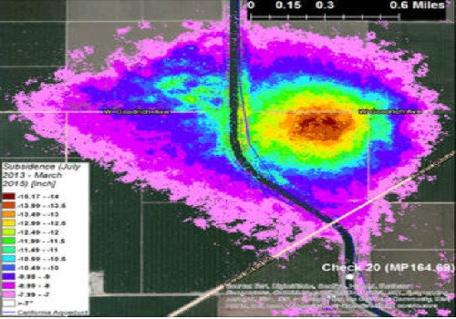 Aug 20, 2015
California Drought Causing Valley Land to Sink
UAVSAR and other SAR instruments are used by JPL researchers to map ground subsidence in California's Central Valley.
Read More
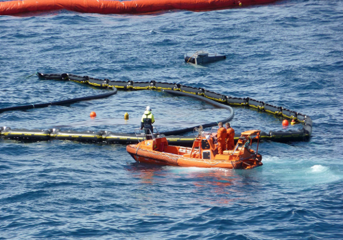 Jun 18, 2015
NASA Joins North Sea Oil Cleanup Training Exercise
UAVSAR participated for the first time in Norway's annual oil spill cleanup exercise in the North Sea on June 8 through 11.
Read More
 Jun 16, 2015
NASA Eyes Study Louisiana's Changing Wetlands
NASA recently completed an intensive study of Louisiana Gulf Coast levees and wetlands, making measurements with three advanced imaging instruments on two research aircraft.
Read More
 Sep 10, 2014
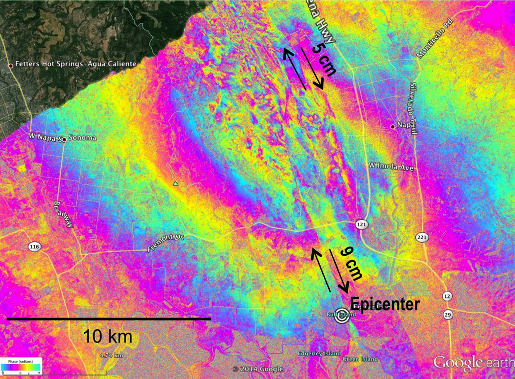
NASA Research Aids Response to Napa Quake
NASA data and expertise are proving invaluable in California's ongoing response to the Aug. 24 earthquake in Napa Valley.
Read More
 Aug 29, 2014
NASA Radar System Surveys Napa Quake Area
NASA scientists are conducting an airborne survey of earthquake fault displacements in the Napa Valley area of California using UAVSAR.
Read More
 Apr 30, 2014
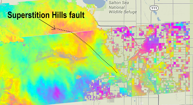
California Faults Moved Quietly After Baja Quake
A new NASA study finds that a major 2010 earthquake in northern Mexico triggered quiet, non-shaking motions on several Southern California faults
Read More
 Apr 1, 2014
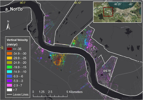
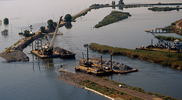
NASA Radar Watches Over California's Aging Levees
NASA's UAVSAR is monitoring levees for early signs of stress that could lead to failure.
Read More
 Mar 6, 2014
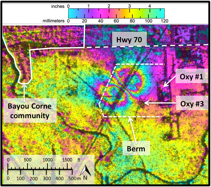
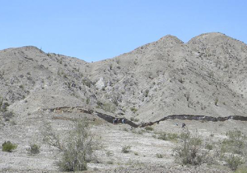
NASA Radar Demonstrates Ability to Foresee Sinkholes
UAVSAR data reveal indications of a huge sinkhole before it collapsed and forced evacuations.
Read More
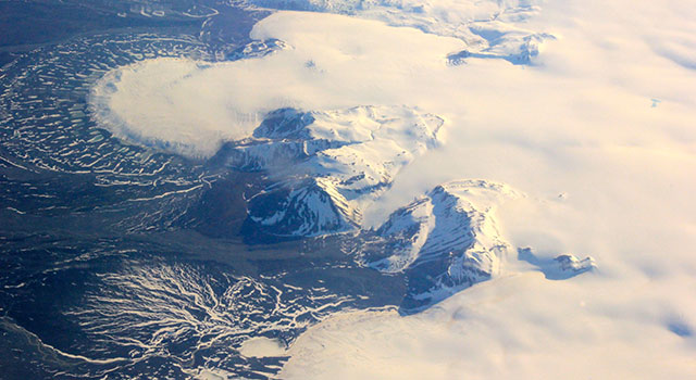 Jan 28, 2014
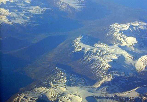
NASA Radar Maps the Winter Pace of Iceland's Glaciers
UAVSAR data will help scientists better understand processes involved in melting glaciers - contributors to rising sea levels.
Read More
 Apr 3, 2013
NASA Flies Radar South on Wide-Ranging Expedition
UAVSAR showcases its broad scientific prowess for studying our home planet during a month-long expedition over the Americas.
Read More
 Oct 25, 2012
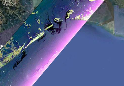
NASA Radar Penetrates Thick, Thin of Gulf Oil Spill
JPL researchers demonstrate that UAVSAR can be used to characterize oil
Read More
 Oct 2, 2012
NASA Radar to Study Volcanoes in Alaska, Japan
UAVSAR left CA for a 10-day campaign to study volcanoes in Alaska and Japan
Read More
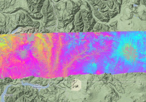
 Aug 10, 2012
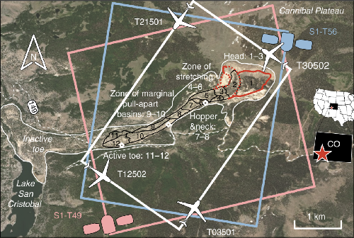
NASA Conducts Airborne Study of Colorado Landslide
UAVSAR data is used to create a detailed 3D map of landslide motion
Read More
 Jun 7, 2012
NASA Airborne Radar Studies Icelandic Ice Caps
UAVSAR heads back to Iceland to study the glacial velocity of ice caps
Read More
 Feb 9, 2012
3-D Map Study Shows Before-After of 2010 Mexico Quake
UAVSAR continues to track deformation after the 2010 Mexicali earthquake
Read More
 Jan 17, 2012
Hawaiian Volcano Study
UAVSAR returns to Hawaii to understand processes occuring under Earth''s surface
Read More
 Dec 20, 2011
Soil Moisture Vegetation
UAVSAR flies with other airborne instruments over California''s San Joaquin Valley
Read More
 Apr 27, 2011
Costa Rica Deployment
UAVSAR flies to Central America on volcano mission
Read More
 Dec 16, 2010
Mexicali Earthquake
Quake studies uncover suprises for California
Read More
 Jul 1, 2010
Gulf Oil Spill
UAVSAR images the coastline to track the extent of the oil spill on wetlands
Read More
 Jan 26, 2010
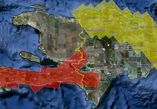
Haiti Earthquake
UAVSAR flies over Haiti to study earthquake faults
Read More
 Jun 29, 2009
Arctic Ice Radar Mission
UAVSAR flies to Greenland Iceland to study glaciers, ice streams, and topography
Read More
