Featured Articles
 Feb 19, 2025
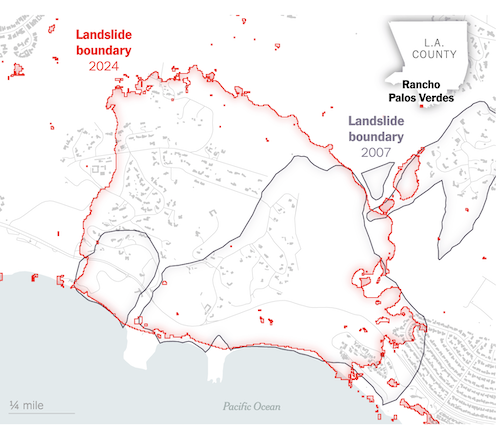
A Slow-Moving California Landslide Suddenly Speeds Up
A new map shows where land movement is accelerating, buckling roads and collapsing homes.
Read More
 Aug 16, 2024
NASA ready for takeoff in Yellowknife
The ABoVE project maps the landscape in the Northwest Territories to see the changes year-to-year such as melting permafrost and regrowth after wildfire.
Read More
 Jan 26, 2021
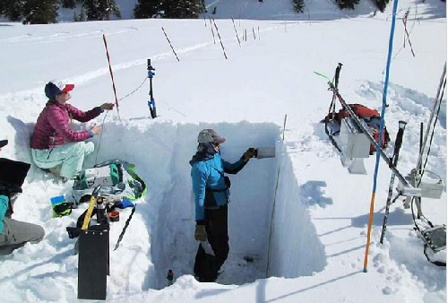
Can NASA satellites help monitor snowpack across the SW USA?
SnowEX researchers develop new methods to measure the snowpack with airborne observations
Read More
 Aug 12, 2019
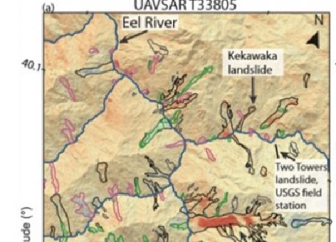
Landslide Activity Ramps Up With Extreme Rainfall
The August 'EOS Editor Highlights' describes studies using UAVSAR observations to understand landslides in California
Read More
 Oct 1, 2018
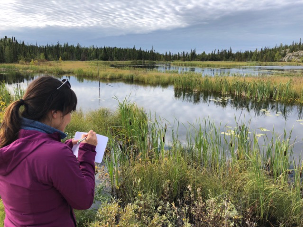
Students Traverse Land, Air, and Water in Canada
One of NASA's projects is called the Arctic-Boreal Vulnerability Experiment (ABoVE), which is studying climate change in the northern parts of the world. People from the circumpolar regions have
Read More
 Sep 26, 2018
Greenland and the Hunt for Better Climate Science
Flying over eastern Greenland, the NASA scientists stared down from a Gulfstream jet as it followed the precise course they had flown in previous years - using radar to map the loss of ice.
Read More
 Sep 19, 2018
What's Like at the Ground Zero of Climate Change
Reuters photographer Lucas Jackson discusses Greenland's large impact on climate, and interviews NASA scientists that are documenting glacier melt as part of the OMG mission.
Read More
 Jan 11, 2018
New Maps Show Fault Line At Site Of 2014 Napa Earthquake
The California Geological Survey released official maps of seismic hazard zones. UAVSAR-derived motion maps were central for seismologists identifying and confirming fault lines.
Read More
 Jun 8, 2017
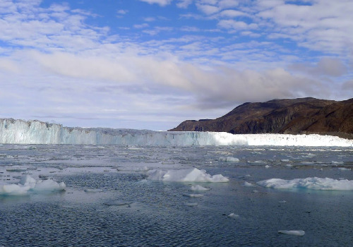
Greenland's Thinning Ice
With temperatures around the world climbing, melt waters from the continental ice sheets of Greenland and Antarctica are raising sea levels.
Read More
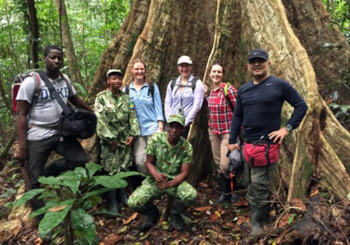 Mar 9, 2016
AfriSAR in Gabon
Scientists blog about collecting tree structure and soil moisture measurements in Lope National Park, Gabon
Read More
 Jan 23, 2016
Tecnologia de la NASA se usara en zonas protegidas
Ministerio de Cultura accede a imgaenes en alta definicion de area intangible de Nazca, gracias a un convenio internacional
Read More
 Aug 24, 2015
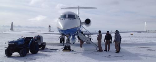
Disaster Prevention in a Gulfstream
Earthquakes, volcanoes, mudslides: Airborne radar watches all the ways the earth moves.
Read More
 Jul 29, 2015
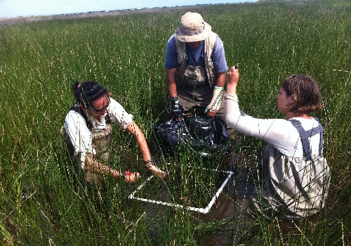
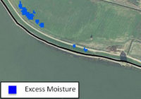
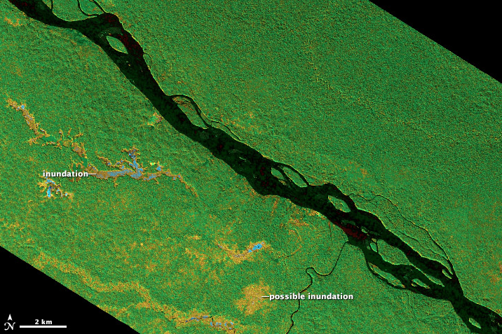
NASA Surveying Effort Tracks Gulf Coasts Changing Wetlands
UAVSAR is part of a multi-instrument mission that studies vegetation and hydrology in Louisiana's marshes.
Read More
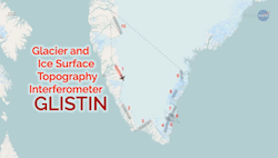
 Jul 28, 2015
NASA launches mission to Greenland
The Ka-band instrument GLISTIN-A will be part of NASA's OMG (Oceans Melting Greenland) mission whose goal is to study Greenland's ice sheet.
Read More
 Feb 27, 2015
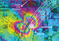
UAVSAR investigators featured on BBC article about sinkholes
JPL researchers Ronald Blom and Cathleen Jones talked to BBC about their work on mapping sinkholes in Louisiana with UAVSAR imagery.
Read More
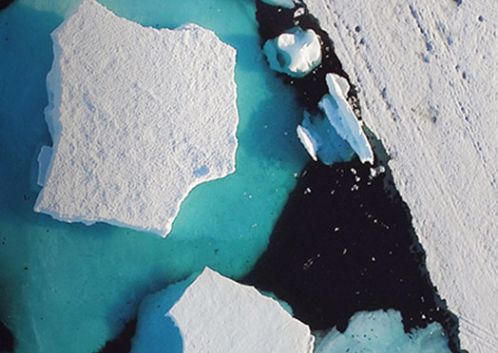
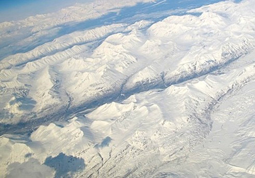
 Feb 11, 2014
NASA completes radar study of Icelandic glacier winter movement
The cold of an Icelandic winter did not stop one NASA science aircraft from completing a mission to map glaciers in Iceland.
Read More
 Dec 19, 2013
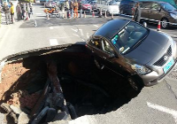
Surprise: Louisiana Sinkhole Slid Sideways Before Collapsing
UAVSAR detected Louisiana sinkhole a month before it collapsed.
Read More
 Jul 3, 2013
JPL Partners with DWR to Scan Levees from the Sky
The California Council on Science and Technology wrote an article about Dr. Cathleen Jones's work using UAVSAR data to map Levees and Subsidence in the Sacramento-San Joaquin Delta.
Read More
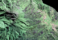 May 29, 2013
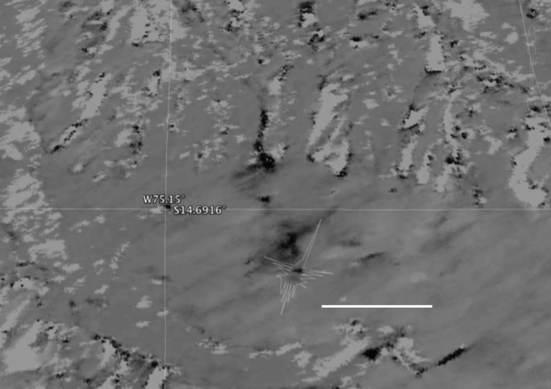
Sizing Up Galeras
When studying volcanoes, detecting even the slightest movements of the land surface can tell a lot about what is happening below.
Read More
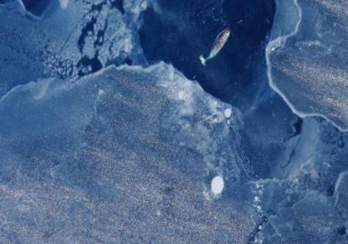
 Apr 30, 2013
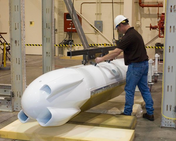
NASA Radar Collects GLISTIN Ice and Glacier Data
Glaciers, sea ice and snow were the focus of a recent airborne Earth science study using NASA's UAVSAR.
Read More
 Apr 25, 2013
Penetrating Tree Cover to See the Forest Floor
Tropical forests and wetlands are some of the most compelling and important areas of study for Earth scientists and ecologists, but they are notoriously hard to penetrate on foot or from the air.
Read More
 Jet Propulsion Laboratory
California Institute of Technology
BRING THE UNIVERSE TO YOU:
JPL Email News |
RSS |
Podcast |
Video
Jet Propulsion Laboratory
California Institute of Technology
BRING THE UNIVERSE TO YOU:
JPL Email News |
RSS |
Podcast |
Video