Deployment not found. Please find a deployment on the search page.
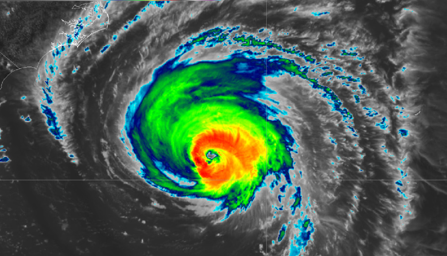
Florence Deployment (L-band)
Sep 15–Sep 24, 2018
This deployment is open to flight request submissions through the SOFRS page. If you need any assistance, please contact us.
North and South Carolinas
Hurricane Florence's storm surge and heavy inland rainfall will impact coastal barrier islands and produce widespread riverine and flash flooding, which is challenging to observe through optical remote sensing due to extensive cloud cover, and at publicly available Synthetic Aperture Radar (SAR) wavelengths due to widespread vegetation. This is particularly important at the urban-suburban interface where vegetation may obscure impacts to people in their communities. While streamflow models provide some insights into flood extent through stream gauges, depth grids, and other outputs, Uninhabited Aerial Vehicle Synthetic Aperture Radar (UAVSAR) imagery provides a unique and valuable opportunity to map actual floodwater extent to provide 1) validation to these physical models 2) opportunities to improve them 3) new data sets in challenging complex terrain and vegetation where flood monitoring from SAR needs continuous improvement and 4) near real-time and/or reduced latency use of the imagery to support disaster response and recovery. UAVSAR imagery collected for this event will meet these complementary objectives while benefiting local, state and federal partners in the affected states.
Duan, D. & Wang, Y. (2021). Reflection of and vision for the decomposition algorithm development and application in earth observation studies using PolSAR technique and data. Remote Sensing of Environment 261, 112498. Paper / Peer-reviewed
Duan, D., Wang, Y., Zhang, Y. (2024). The critical role of cross-polarized backscatter in understanding L-band PolSAR data in forested and urban environments. In Remote Sensing of Environment (Vol. 311, p. 114265). Elsevier BV. Paper / Peer-reviewed
Kundu, S., Lakshmi, V. & Torres, R. (2021). Estimation of flood inundation and depth during Hurricane Florence using Sentinel-1 and UAVSAR data. Paper / Peer-reviewed
Kundu, S., Lakshmi, V. & Torres, R. (2022). Estimation of Flood Inundation and Depth During Hurricane Florence Using Sentinel-1 and UAVSAR Data. IEEE Geoscience and Remote Sensing Letters 19, 1–5. Paper / Peer-reviewed
Lou, Y., S. Hensley, B. Chapman, B. Hawkins, C. Jones, P. Lundgren, T. Michel, R. Muellerschoen, N. Pinto, and Y. Zheng. "Recent Airborne Sar Demonstrations for Monitoring and Assessment of Volcanic Lava Flow and Severe Flooding." In IGARSS 2019-2019 IEEE International Geoscience and Remote Sensing Symposium, pp. 9388-9390. IEEE, 2019. Paper / Peer-reviewed
Melancon, A., Molthan, A., Griffin, R., Mecikalski, J., Schultz, L., and Bell, J., "Mapping Inundation from Hurricane Florence (2018) with L-Band Synthetic Aperture Radar, Commercial Imagery, and Ancillary Data via Random Forest Classification," AGU Fall Meeting, New Orleans, USA, 2021 Abstract
Melancon, A.M., Molthan, A.L., Griffin, R.E., Mecikalski, J.R., Schultz, L.A. & Bell, J.R. (2021). Random Forest Classification of Inundation Following Hurricane Florence (2018) via L-Band Synthetic Aperture Radar and Ancillary Datasets. Remote Sensing 13, 5098. Paper / Peer-reviewed
Michael Denbina, Zaid Towfic, Matthew Thill, Brian Bue, Neda Kasraee, Annemarie Peacock, and Yunling Lou (2020). Flood Mapping Using UAVSAR and Convolutional Neural Networks. Geoscience and Remote Sensing (IGARSS), IEEE International Symposium. Abstract / Peer-reviewed
Molthan A., Melancon A., Bell J.R., Schultz L.A, and Gebremichael E. "Flood Mapping of Recent Major Hurricane Events with Synthetic Aperture Radar, Commercial Imaging, and Aerial Observations," AGU Fall Meeting, San Francisco, USA, 2019 Abstract
Salem, A. Hashemi-Beni, L. (2022). Inundated Vegetation Mapping Using SAR Data: A Comparison of Polarization Configurations of UAVSAR L-Band and Sentinel C-Band. Remote Sensing. Paper / Peer-reviewed
Salem, A., and Beni, L., "COMPARISON BETWEEN FULL POLARIZED L-BAND SAR DATA AND DUAL POLARIZED C-BAND SAR DATA FOR INUNDATED VEGETATION MAPPING IN EASTERN NORTH CAROLINA," AGU Fall Meeting, New Orleans, USA, 2021 Abstract
Shen X., Yang Q., Anagnostou E.N., Kettner A., Jones J.W., and Schumann G. "A partial polarimetric decomposition-based method for delineating wetlands/inundation under vegetation, " AGU Fall Meeting, San Francisco, USA, 2019 Abstract
Wang, C., Pavelsky, T., Yao, F., Yang, X., and Zhang, S., “Repeat-pass L-band UAVSAR images for flood extents mapping during Hurricane Florence”, AGU Fall Meeting, Online, 2020 Abstract
Wang, C., Pavelsky, T.M., Yao, F., Yang, X., Zhang, S., Chapman, B., Song, C., Sebastian, A., Frizzelle, B., Frankenberg, E. & Clinton, N. (2022). Flood Extent Mapping During Hurricane Florence With Repeat?Pass L?Band UAVSAR Images. Water Resources Research 58. Paper / Peer-reviewed
Wang, C., Song, C., Schroeder, T.A., Woodcock, C.E., Pavelsky, T.M., Han, Q. and Yao, F., 2025. Interpretable Multi-Sensor Fusion of Optical and SAR Data for GEDI-Based Canopy Height Mapping in Southeastern North Carolina. Remote Sensing, 17(9), p.1536. Paper / Peer-reviewed