Brigot, G., Simard, M., Colin-Koeniguer, E. Boulch, A. (2019). Retrieval of Forest Vertical Structure from PolInSAR Data by Machine Learning Using LIDAR-Derived Features. Remote Sensing 11, 381. Paper / Peer-reviewed
Denbina, M. Simard, M. (2016). The effects of temporal decorrelation and topographic slope on forest height retrieval using airborne repeat-pass L-band polarimetric SAR interferometry. 2016 IEEE International Geoscience and Remote Sensing Symposium (IGARSS). Paper / Peer-reviewed
Estep J., Shaw J., Edmonds D. "Measuring Delta Progradation Using Delta Front Flow Patterns: A New Method of Remote Imagery Analysis on the Wax Lake Delta, Louisiana, U.S.A." AGU Fall Meeting, San Francisco, USA, 2015.
Jones, C. (2024). Sinkholes. In Remote Sensing for Characterization of Geohazards and Natural Resources (pp. 371-387). Cham: Springer International Publishing. Book Chapter
Jones, C.E., An, K., Blom, R.G., Kent, J.D., Ivins, E.R. Bekaert, D. (2016). Anthropogenic and geologic influences on subsidence in the vicinity of New Orleans, Louisiana. Journal of Geophysical Research: Solid Earth 121, 38673887. Paper / Peer-reviewed
Li, Y., Lin, H., Zhang, Y. Chen, J. (2015). Comparisons of Circular Transmit and Linear Receive Compact Polarimetric SAR Features for Oil Slicks Discrimination. Journal of Sensors 2015, 1-14. Paper / Peer-reviewed
M. Cui et al., "Decision Fusion of Textural Features Derived From Polarimetric Data for Levee Assessment," IEEE J. Sel. Top. Appl. Earth Observations Remote Sensing, vol. 5, no. 3, pp. 970-976, Jun. 2012. Paper / Peer-reviewed
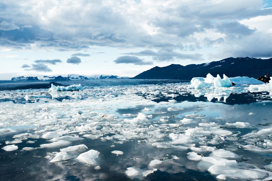
Minchew B.M, Simons M., Hensley S., Larour E.Y, Morlighem M., Bjornsson H., et al. "Temporal variation of basal stress in temperate Icelandic glaciers during the early melt season," AGU Fall Meeting, San Francisco, USA, 2013 Poster
Ni-Meister, W. (2016). Fusion of LiDAR and radar for vegetation structure and biomass retrieval. 2016 IEEE International Geoscience and Remote Sensing Symposium (IGARSS). Paper / Peer-reviewed
Prasad, A. R., Kumar D C, S., Hegde, A., Rananavare, L. B. (2024). Utilizing H/A/Alpha Decomposition on Simulated NISAR Data for Water Body Mapping. In 2024 IEEE International Conference on Electronics, Computing and Communication Technologies (CONECCT) (pp. 1-6). Paper / Peer-reviewed
Shaw, J.B., Ayoub, F., Jones, C.E., Lamb, M.P., Holt, B., Wagner, R.W., Coffey, T.S., Chadwick, J.A. Mohrig, D. (2016). Airborne radar imaging of subaqueous channel evolution in Wax Lake Delta, Louisiana, USA. Geophysical Research Letters 43, 50355042. Paper / Peer-reviewed
Simard, M., Riel, B.V., Denbina, M. Hensley, S. (2016). Radiometric Correction of Airborne Radar Images Over Forested Terrain With Topography. IEEE Transactions on Geoscience and Remote Sensing DOI: 10.1109/TGRS.2016.2543142. Paper / Peer-reviewed
Zhao, J., Niu, Y., Lu, Z., Yang, J., Li, P. Liu, W. (2018). APPLICABILITY ASSESSMENT OF UAVSAR DATA IN WETLAND MONITORING: A CASE STUDY OF LOUISIANA WETLAND. ISPRS - International Archives of the Photogrammetry, Remote Sensing and Spatial Information Sciences XLII-3, 2375 - 2378. Conference Paper / Peer-reviewed