
Infographics

Infographic of the UAVSAR plane
The airplane is managed by NASA Armstrong Flight Research Center (AFRC).Print this infographic (PDF)

Postcards
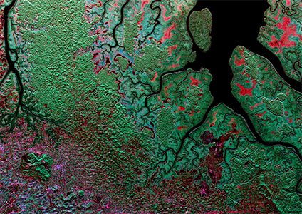
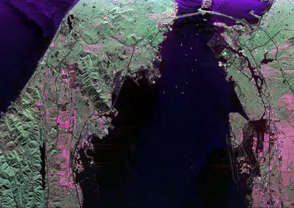
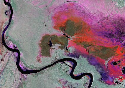
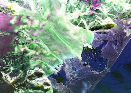
Radar image (channels: HH-VV HV HH+HV) of Gabon's Akanda National Park and city of Libreville
(March 6, 2016)
This false color composite reveals the dominant structure of the landscape. Areas by color: red and pink are flooded vegetation and urban areas, while green is forests and mangroves.Image (PNG)
Print this postcard (PDF)
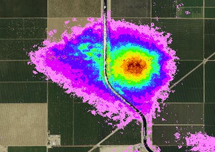
UAVSAR-derived image overlayed on Google Earth of land sinking (subsidence) near Huron and Kettleman City, California
(July 2013 to March 2015)
This image shows areas where subsidence exceeded 7 inches. The land is subsiding in the Central Valley due to groundwater pumping in response to CA's historic drought.Image (JPG)
Print this postcard (PDF)
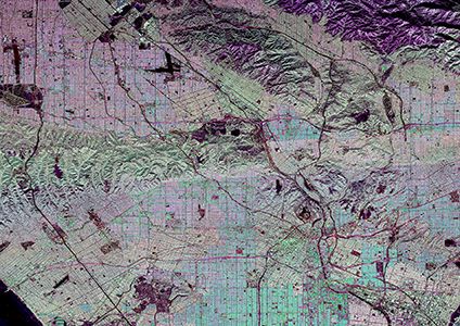
Polarmetric SAR image (channels: HH HV VV) of Los Angeles, California
(October 2014)
Image (JPG)
Print this postcard (PDF)
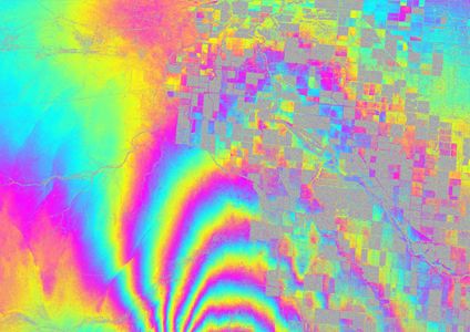
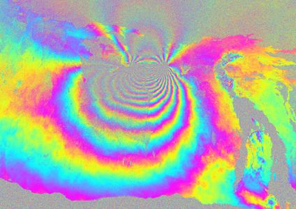
Interferometric image of the 2010 Baja California Earthquake
(October 20, 2009 & April 13, 2010)
This image of the El Mayor - Cucapah Earthquake (April 4, 2010) shows surface ruptures not seen from space-borne instruments.Image (PNG)
Print this postcard (PDF)
Data download page
Polarmetric SAR image (channels: HH HV VV) of California's San Francisco Bay Area
(February 18, 2009)
Image (PNG)
Print this postcard (PDF)
Data download page
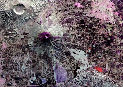
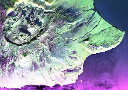
Interferometric image of Hawaii's Kilauea Volcano
(January 4, 2010 & May 7, 2011)
Located on Hawai'i Island (the Big Island), Kilauea is a currently hyperactive shield volcano, frequently outpouring lava. Its current eruption dates back to January 3, 1983.Image (PNG)
Print this postcard (PDF)
Data download page
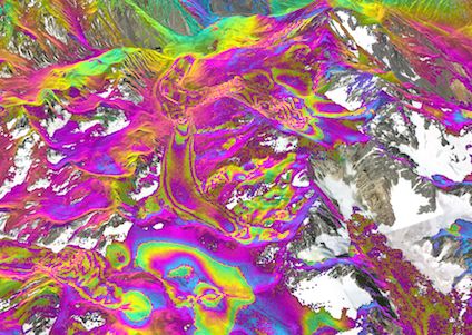
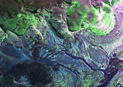
Interferometric image of Chile's Rio Los Cipreses National Reserve
(March 25 & 27, 2013)
The colors correspond to small amounts of ground movement that occurred between the two dates. Rapid color changes show where the glacier is moving more quickly. The colors are draped over Google Earth. Image (PNG)
Print this postcard (PDF)
Data download page
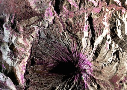
Cordon del Azufre volcanic complex,
Chile & Argentina
(March 24, 2013)
Image (JPG)
Print this postcard (PDF)
Data download page
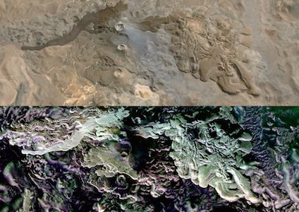
Polarmetric SAR image (channels: HH HV VV) of Peru's Pacaya-Samiria National Reserve
(March 17, 2013)
Areas by color: black is open water, grayish-green is tropical forest, dark green is low vegetation, perhaps floating vegetation, while red and pink are two different types of inundated vegetation. Image (PNG)
Print this postcard (PDF)
Data download page
Polarimetric SAR image (channels: HH HV VV) of Ecuador's Tungurahua Volcano
(March 15, 2013)
As one of Ecuador's most active volcanoes, Tungurahua has had several major eruptions since volcanic activity restarted in August 1999.
Image (JPG)
Print this postcard (PDF)
Data download page
Polarimetric SAR image (channels: HH HV VV) of El Salvador's San Miguel Volcano
(March 8, 2013)
San Miguel last erupted on December 29, 2013, prompting the evacuation of thousands of people living in a3 km radius of the volcano.
Image (JPG)
Print this postcard (PDF)
Data download page
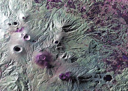
Polarimetric SAR image of Japan's Kyushu Volcanoes (October 5, 2012)
Kirishima is a group of more than 20 active volcanoes on Kyushu. Japan's third largest island. It last eruped in August of 2011.Image (PNG)
Print this postcard (PDF)
Data download page
Polarimetric SAR image of Iceland's Vatnajokull Glacier (June 3, 2012)
Vatnajokull is the largest ice cap in Europe by volume, with an average ice thickness of 400 meters. Like many glaciers of Iceland, Vatnajokull has several volcanoes.Image (PNG)
Print this postcard (PDF)
Data download page
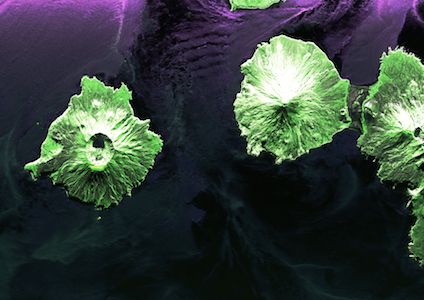
Polarimetric SAR image of Alaska's Aleutian Islands (August 11, 2011)
Umnak is the third largest island in the Aleutian archipelago and its volcanic aldera on Mount Okmok contains the only field of geysers in Alaska.Image (PNG)
Print this postcard (PDF)
Data download page
Polarimetric SAR image of Alaska's Aleutian Islands (August 4, 2010)
Herbert (left) and Chuginadak (right) are part of the Islands of Four Mountains, each of which has its own prominent volcano. Mount Cleveland volcano on Chuginadak is currently active, erupting at least 22 times in the last 230 years.Image (JPG)
Print this postcard (PDF)
Data download page
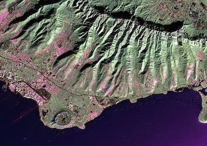
Polarimetric Image of Southeast Oahu, HI (January 10, 2010)
Image (JPG)
Print this postcard (PDF)
Data download page
Polarimetric SAR image of Hofsjokull, Iceland (June 12, 2009)
The blue areas are bare ground surfaces andthe green areas are ice.
Image (JPG)
Print this postcard (PDF)
Data download page
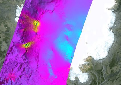
Interferometric SAR image of Hofsjokull, Iceland (June 10-11, 2009)
The colors indicate the glacial velocity where yellow is moving to the northwest and turquoise is moving to the southeast.Image (PNG)
Postcard front
Postcard back